|


Click on thumbnail above for full size picture
CLICK HERE FOR WALKING MAP
BRIXTON DEVERILL TO BIDCOMBE HILL
| Waypoint |
Map Reference |
Bearing to next waypoint |
| START |
ST 8637 3876 |
289 |
|
WP1
|
ST 8628 3878
|
353
|
| WP2 |
ST 8626 3890 |
304 |
| WP3 |
ST 8581 3914 |
270 |
| WP4 |
ST 8537 3911 |
226 |
| WP5 |
ST 8459 3825 |
291 |
| WP6 |
ST 8298 3877 |
312 |
| WP7 |
ST 8274 3896 |
6 |
| WP8 |
ST 8277 3986 |
94 |
| WP9 |
ST 8422 3984 |
357 |
| WP10 |
ST 8420 3995 |
84 |
| WP11 |
ST 8571 4024 |
175 |
| WP12 |
ST 8611 3895 |
132 |
| START |
ST 8637 3876 |
- |
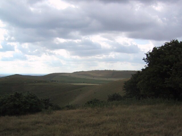
General:- A 6.5 mile through an area known as "The Deverills" because so many of the villages have this in their name. It's renowned for its countryside but the landscape is hard to describe, mainly because of it's variety. One minute you are high up on open downland and the next dropping through a wood to a hidden valley or pretty village. The first half of this route is on downland and it's a long steady climb to get up there but then its an easy glide back home. To get the best out of it you need a clear sunny day. Avoid the winter, it's pretty bleak when the weather has a temper on.
Parking in Brixton Deverill is not easy. Try the area around the church and hunt around for a spare bit of grass verge. The village is small, there's not pub for refreshment. Take a picnic up onto the hills and while away the day in a glorious world of your own, I doubt if you will see anyone else.
GPS route length 6.29 miles.
How to get there:- Turn off the A350 at Longbridge Deverill @ ST 8694 4076 and Brixton Deverill is 1.2 miles further on.
|