|


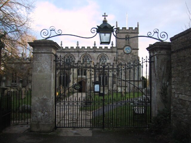
Click on thumbnail to view full size picture of Seend church
CLICK HERE FOR WALKING MAP
SEEND to POULSHOT
| Waypoint |
Map Reference |
Bearing to next waypoint |
| START |
ST 9433 6121 |
23 |
|
WP1
|
ST 9450 6169
|
94
|
| WP2 |
ST 9654 6169 |
102 |
| WP3 |
ST 9683 6165 |
187 |
| WP4 |
ST 9681 6127 |
202 |
| WP5 |
ST 9654 6043 |
146 |
| WP6 |
ST 9678 6012 |
133 |
| WP7 |
ST 9669 5985 |
67 |
| WP8 |
ST 9584 6043 |
266 |
| WP9 |
ST 9512 6108 |
337 |
| WP10 |
ST 9447 6091 |
340 |
| START |
ST 9433 6121 |
- |
General:- This 5 mile walk will look familiar to anyone who watched the BBC TV program "A Country Parish", the path goes right through the featured village of Seend and past the vicar's church. The Rev Jamie Allen's flock is a far more balanced community than I first imagined, the section between waypoints 9 & 10 displayed all the wealth I expected but on the other side of the road lived ordinary people. To me a well used village hall and a football pitch is a healthy sign, it does them credit. Take a walk through Seend yourself and make up your own mind.
Half of this walk runs alongside the Kennett & Avon canal. The pumping station at waypoint 2 is new and funded by the lottery to pump water back up to the top of the fourteen Caen Hill locks. I marvel at the determination of the early engineers to link the rivers Thames & Avon. This hill up to Devizes was their greatest challenge and nearly their undoing. It tested the volunteers who restored it too but at last their dreams seem a reality.
(GPS route length 4.84 miles)
How to get there :- Park in the village hall car park (drop a donation in the box if there is one). Seend is on the A361 Semington to Devizes road. Turn down Rusty lane @ ST 9439 6107 where it's signposted to village hall.
|